- Robin
- Starling
- House Sparrow
- Song Thrush
- Wood Pigeon
- Mallard
- Teal
- Crow
- Magpie
- Meadow Pipit
- Great Tit
- Long Tailed Tit
- Redshank
- Brent Goose
- Lapwing
- Black Headed Gull
- Herring Gull
- Great Black-Backed Gull
- Little Egret
- Cormorant
- Curlew
- Heron
- Jay
- Stonechat
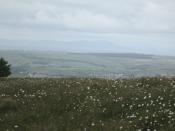
Spent a very enjoyable couple of hours at Wick Fields and Hengistbury Head this afternoon with my binoculars for the first bird watching outing of the year. Now, traditionally this takes place on 1st January, but was a bit too busy sleeping off the champers yesterday. Nothing out of the ordinary spotted, but a good count nonetheless. It was very busy up on the Head, and my usual birdie route along side the heronry was closed off as there is currently a bull in the field. So had to battle with the crowds and a broken down land train for a while until got to the path to cut up to quarry pond. Meanwhile, Pete was thrashing radio controlled cars about in the big field. Photos courtesy of the interweb. I've listed everything (memory permitting), even the very common ones as they all count to start off the year list. Might have done a bit better with my telescope....next time.
0 Comments
What a fab day. Having shaken off horrid cold (hurrah!), I was determined to get out and enjoy the sunshine. We drove over to Keyhaven and walked along the sea wall into Lymington, enjoying a spot of bird watching on the way. Saw my first terns of the year - little and common - and plenty of linnets, lapwing, oystercatchers, various gulls, reed warblers and lots of ducks, geese and swans with their fluffy youngsters. Had a spot of lunch in Lymington down by the quay and then headed back along the lanes and cycle path to Keyhaven and the car. There was an arts & crafts market in Lymington. Pete has bought us a lovely new print for the hallway of The Needles in the style of the old railway posters. I love a bit of art deco, me. On the way home we stopped at the Beach House pub in Milford-on-Sea. Such a gorgeous building - and I'm really glad that it hasn't changed from the Westover Hotel. Very tastefully done and the views from the garden across to the Island are stunning. A nice pint of "Billy Stinger" nettle beer whilst resting one's legs went down a treat. Must look into getting the bus over there for a leisurely lunch at some point. The hall is a Grade II Listed Victorian mansion, built in 1897 for the German industrialist Alexander Siemens by Arnold Mitchell. The mansion has ravishing stained glass windows portraying Pre-Raphaelite scenes from the "The Enchanted Wood". There is a splendid oak panelled hall, which is now where the bar is. The dining room, library, and drawing room with a huge carved stone fireplace all come off the hall. There is a minstrels gallery above the hall and the guest rooms look stunning on their web site. There are some amusing prints in the library with the faces of the Hall and Woodhouse founders made to look like cluedo figures. It is a lovely place and is now officially my new most favourite pub in the world ever. Back at home, after a hot bath and plenty of aftersun I pop the telly on to find that two 80's classics are on Channel 5 so settling in to watch Mannequin and Dirty Dancing this evening. Looking forward to my White Horse trail at end of July - and who knows, might even get an outing with full back pack and tent before the end of the year! Loving the British summer so far. PS Nobody puts baby in the corner. I meant to add these yesterday when I blogged the walk. There were some lovely butterflies and other wildlife spotted while were were out. Can't take credit for any of these photos though - gotta love google for that! Most are from RSPB and Portland Bird Observatory. The butterflies are from UK Butterflies web site. They are a nice reminder of how colourful and diverse our UK wildlife is.
What a glorious day! The coast path between Kimmeridge and Houns Tout cliff has been made safe and re-opened after the winter land slips. This 10 mile loop is one of my very favourites as it has spectacular views and some good climbs. Pete and I picked up Annie & Grae and we started walking from Kinsgston Matravers at about 12.30. We set off west to climb Swyre Head where there is a well preserved tumulus. Then along Smedmore Hill and through the wonderfully named 'Heaven's Gate' to drop down to the coast at Kimmeridge. This is the view west towards Kimmeridge Bay from Smedmore Hill. You can just about make out the Isle of Portland on the horizon. As we were walking down the hill (which cyclists can use as it is also a bridleway), a cyclist kept cycling up and down and back up the steepest part. Said he was in training. Just a tad too smug - was sorely tempted to prod him with my trekking pole....but thought better of it. There are shale beds at Kimmeridge Bay and oil has been drilled there since the 1950's. From the beach there is a steep climb (a taste of things to come) up to Clavell Tower. The tower was built as a folly in 1831 by John Richards Clavell of Smedmore House. It is the setting for Thomas Hardy's novel Two on A Tower. Threatened by cliff erosion, it was in imminent danger of toppling into the sea. In 2006 it was carefully dismantled, each of its 16,732 stones photographed and numbered before being reassembled 25 meters inland. The £900K cost was met by the Landmark Trust who now own the tower and let it for 2 people to stay in....cool! The walk turns back inland after a well earned rest on the big stone bench at the top of the climb. From there it's just another couple of miles back to the typical Purbeck village and the Scott Arms at Kingston Matravers. I had a pint of Jurrasic; Pete had a pint of something like Quad Drop - both were jolly good. We sat at a huge stone tablet in the garden which overlooks Corfe Castle and beyond to Poole Harbour. Super walk in the afternoon sunshine. So much for my trip to Devon and the East Devon Way!I had been planning the East Devon Way as my last walk before putting the tent away this year. I booked off the week of 14th October, booked the campsites and planned to head down to my bestest sister Linda's in Exmouth on Saturday 11th, stay for a few days and then walk back via the EDW from there to Lyme Regis over 4 days, back to work on 21st. Two things scuppered this plan....
DAY 1 - Blandford to Sturmninster Newton (13.5 miles) 10/09/13 And so to the final stages of the Stour Valley Way. I had a week off work and had planned to use some of it to finish the SVW. Having walked the first half as practice for the Coast to Coast, I was keen to complete this and follow the river Stour from the sea at Christchurch to its source at Stourhead, 64 miles earlier. A bit of planning was involved, as there was only one campsite convenient to the path. I booked 2 nights at 'Osho Leela' on 10th and 11th September and walked from Blandford Forum to Sturminster Newton on day 1, getting the bus onwards to Gillingham to camp there overnight. Pete dropped me off at Blandford and I waved goodbye to him for the next 2 nights and set off walking at 9.30 am. I needed an early start as the last bus from Sturminster to Gillingham was at 16.20 and I did not want to miss it! The walk initially goes through the grounds of the rather exclusive Bryanston School (£10,738 a term, with very impressive equestrian facilities in case you were wondering) and into the very small village of Durweston. From there I was on familiar territory as I crossed into Stourpaine and then up and over the Iron Age forts of Hod Hill and Hambledon Hill, where I stopped for lunch and watched a kestrel using the thermals to hunt. Also spotted many Adonis Blue butterflies, nice to see, and probably the last of the summer's swallows. I had been tempted by a new trailway at Stourpaine which uses disused railway track all the way into Sturminster Newton, but why miss out on the hills. And I know how much I would have been bugged by not sticking to the official path, even it is a part I've done several times before. It was bad enough getting OCD in the car on the way to Blandford because I had put my clean clothes in the green dry-bag instead of the usual blue one! Guess what I did first when I got to the campsite....As it turned out, I picked up the trailway just beyond Child Okeford due to diversions and headed for Fiddleford Mill and the 14th century manor house there. Unless I missed something, I didn't see much of the mill, but the weir there was interesting and reminded me of a smaller version of Pultney weir at Bath. There was a little hydro-electric plant that worked with an archimedes screw housed inside a wooden shed and down a shute, which I thought was a hatching shed for eels or fish! It blended really well with the old buildings and provided enough power for 35 houses - not much, but every little helps. From Fiddleford it was a short walk into Sturminster Newton, staying close to the river and crossing fields to reach the pretty old market town which was once home to the largest calf market in Europe, fact! Thomas Hardy lived here for a while, as did his contemporary the Dorset dialect poet William Barnes. As I had plenty of time before the bus to Gillingham, I popped into the local co-op for some groceries and had a coffee at Poets Corner cafe with its resident budgies Bobby and Bluebell. Short bus trip to the outskirts of Gillingham and then another mile or so to the campsite at Osho Leela, a spiritual retreat come hippy community come personal development kind of place (I was too early for the autumn conscious sexuality festival and the humaniversity classes, shame). I was slightly afraid I might be forced to participate in some tantric sex workshop or have to discuss my private parts at a gender-balanced intimacy group, but fortunately not. The site was quiet and secluded with good showers if you didn't mind sharing them with the spiders and daddy-long-legs. A little black cat from the nearby farm watched me set up camp. She sat in the hedge for ages, but I couldn't persuade her to come over. Saw her later with a mouse for her supper as I was tucking into bacon butties for mine. Was thinking that today had been a Keats day - season of mists and mellow fruitfulness as his Ode to Autumn has it. The hedgerows were brimming with fruit and nuts. I picked and ate several ripe plums, loads of blackberries (obviously not the ones at the bottom of the hedge...) and there were also rosehips, haws, elderberries, sloes, quince - even grapes and pomegranate in a cottage garden. Then there were acorns, beech nuts, hazel nuts and horse chestnuts. Watched an amazing sunset and drifted off to sleep listening to owls. Got up about 2.30 for the loo - the night sky was so clear I could recognise constellations, but not sure exactly which ones - something to swot up on. DAY 2 - Sturmninster Newton to Gillingham (13.5 miles) 11/09/13 Walked the mile or so into Gillingham town centre this morning and caught the bus back to Sturmninster Newton in order to walk back into Gillingham! This is what happens when there is only one campsite for miles around. I found Gillingham rather dismal and much preferred the rural charm of Sturminster. Once there, I took some time to look around the town and walk down to the mill which, amazingly, is actually by-passed by the official route. The mill is beautiful and is still producing flour. If yesterday was Keats, then today was definitely Hardy with a bit of Tennyson in the mix for good measure. The walk followed the river much more closely today as it meandered through the Vale of Blackmore (Hardy's Vale of the Dairies). In places the river put me in mind of Tennyson's Lady of Shallott (on either side the river lie long fields of barley and of rye, that clothe the wold and meet the sky...and so on down to Camelot) and of the famous pre-Raphaelite painting by Waterhouse. No chance of meeting a Lancelot on a shining charger for me though, and even if I did the backpack would probably be too heavy for him to sweep me off my feet! Heard the distinctive 'splosh' of a water vole, but didn't actually see it. And although there are otters in the Stour hereabouts, I was out of luck there too. But it's nice to know they are there. It was difficult to navigate today as the path wasn't very well signed and the fact that some fields that it crossed had been ploughed over made it impossible to find in places, so a bit more walking along the lanes than I had anticipated, and where I did cross fields I was herded out of them twice by some very pushy bovines. I don't know if it was the sticks, but I got the distinct impression they wanted me out of their fields, and be quick about it. I felt like I was playing that primary school game 'What's the time Mr Wolf' as every time I turned round the cows were following me again. And yet when I (rapidly) crossed the field and stood safely on the other side of the fence it seemed that all they wanted to do was sniff me and have a lick of my hands. Weird. Just glad I didn't have a dog or else I think I might have been stampeded. Also good (I think) that I don't mind having my hands licked by cows. My lunch stop was at Marnhull, which I loved. It is a beautiful village which Thomas Hardy also walked to in 1877 during his 2 years living at Sturminster, probably along the same paths. He saw the old May Day procession there, which features in Tess, and used the village as her birthplace, which he calls Marlott. I sat in the churchyard of St. Gregory's and wondered if the gravestones set in the wall were his inspiration for the D'Urberville graves that made plain Tess Durbeyfield think she came from a noble family. The Crown Inn is called The Pure Drop in the book and the oldest part of the pub has not been changed much since the 16th century. I sat in a small room with original wood panels and pondered if this is where Hardy imagined Tess' father downing many a pint. I only had an Appletize. Leaving Marnhull and Hardy behind, I continued to follow the river by more mills then across fields and along lanes to the wonderfully named Fifehead Magdalen and Stour Provost (so I'm now thinking about Betjeman's poem 'Dorset', what a literary trail this is turning out to be). Ate some scrumptious tomatoes from honesty box at Fifehead and left the money in the letter box on the garden gate. There were lots of stunning cottages and houses, and every car that went past was clearly very expensive, but my oh my, how grumpy all their drivers looked. All that money and they couldn't even crack a smile as a passing walker raised a friendly hand to greet them. I was worried that most of them wouldn't even pull out around me. Bally toffs. It was raining heavily by the time I got back to base, so much so that I found a little leak in the outer of the tent so will have to attend to that when get home. It's into the lobby bit so not going to get wet from it. Cooked in the lobby bit with head torch on, which is great for attracting daddy-long-legs. They go straight for your face as that's where the light's coming from and when you bat them away they fall into your dinner. They have now taken over from midges as my least favourite flying beasties. No sign of the cat tonight, too wet! Have been totting up the expenses and they come to a grand total of £37 for the trip - not bad for three days away. DAY 3 - Gillingham to Stourhead (10.5 miles) 12/09/13 So this is where the rest of the hills are! Lulled into a sense of security be having got what I thought were the big hills out of the way on Day 1, today came as a bit of a surprise. Although I'm not sure why it didn't occur to me that as you got nearer to the source of a river you might be a) up hill and b) across valleys, but there you go. And there I went. It was a damp start as I packed up, but the rain soon cleared so I didn't need my waterproofs. Was glad I hadn't got gortexed up as it got hotter and hotter as the day went on. Again there was a lack of waymarkers today. Day 1 I pretty much knew the route, Day 2 I had a good idea from the bus trips, Day 3 I would have been completely lost a few times so was glad I had saved the GPS batteries for the last day. I was also using a Landranger map on a 1:40000 scale rather than my usual Explorer maps on a 1:25000 scale, so everything seemed further away than it looked on the map. I had arranged to meet Pete at the Spread Eagle pub in the village next to Stourhead at 4pm and thought that would give me plenty of time, but the many faffs to get the rucksack over narrow stiles and through tiny kissing gates together with the several hours (or so it felt) it took me to wait for a safe gap to cross the A303 did mean getting a bit of a rush on at the end. My legs were knackered by the time all was done but there had been some serious power walking along the flat parts and several steep ascents and descents. Again, I was grateful for the flask of coffee that Pete had brought with him, and for his patience as I didn't actually get to him until 45 mins after I had said I would. This last part of the walk was very scenic, with views of the Wessex Ridgeway on my left for most of the day. I'm tempted to do some of that next, weather permitting before putting the tent away for the winter. I stopped for lunch at Silton, a tiny village with a population of just 134, and a gorgeous little church. You may have noticed that I'm quite partial to stopping for lunch in churchyards and today's was particularly picturesque. It was on a hill that fell steeply away to give views over the vale below. Sitting in the walled churchyard I could hear the church organist practicing some well known hymns. I went into to have a look and was taken aback by how lovely the church was inside. The original green, red and gold colourings had been restored to the walls and arches, the roof bosses shone with gold leaf and the massive memorial to a local dignitary from Charles II time dominated one wall with its life-sized statues. Next came Bourton with the remains of a WW1 ordnance factory where Mills bombs were made in vast quantities. Bourton is also where the three counties of Dorset, Wiltshire and Somerset meet. I thought about standing with a foot in each, but then remembered I only have two feet. From there it was the last of the ups and downs through the Stourhead Estate to reach the source of the river itself. The estate is magnificent, and you can glimpse the formal gardens and the Temple of Flora from the high ground above. Then you skirt the gardens (thus avoiding the entry fee) to come to Six Wells Bottom. By this point I was flat out to try to get to Pete for 4 o'clock, but I was determined to get to St. Peter's Pump which marks the source. The pump looks like an old church steeple and dates from 1474. It was originally part of old Bristol's water supply, but was moved here for some reason in 1768. See my photos from the walk here. Anyway. I quick marched it to the pump and back towards the house. I was surprised that the path went for free right in front of the stunning Palladian mansion, which looks like it has been used in many a film set. Few piccies there and then down to the picture postcard village of Stourton where the view into the gardens and across to the Pantheon is stunning. Big hugs from Pete and home to the pussy cat boys and the rest of the week off. New hall floor and repainting hall, stairs and landing. Nice. And here endeth the Stour Vally Way, job done. I've also re-sealed the leaky bit on the tent. Not that I'd let a mere day of torrential rain stop my plans! Pete dropped me off at Corfe Castle on Saturday and I headed off over Ridgeway Hill and across Grange Heath towards the campsite at Wool. It started raining heavily approximately 20 minutes into this 10 mile walk and didn't stop until I got to the campsite. At one point while I was walking through a farm, a collie came running up to me and did the sheepdog thing of sitting very close in to my leg and looking up at me. Cute. I think I may have been confused for a shepherd with my trekking poles! The rain seemed to get heavier as the day went on and it did dampen my spirits somewhat, but only a teeny little bit. Fortunately, there was a brief interruption to the downpour while the weather gods allowed me to pitch my tent. Then it started raining again and didn't stop until Sunday morning. The campsite was basic - the loos and showers were in portakabins, and there was only one tap for drinking water - but it was very clean and the owner was really friendly. Again, my tent was dwarfed by the others on the site, good job I haven't got a Napoleon complex (is there such a thing as small tent syndrome?? Well I think it's small but perfectly formed). I walked another 3 miles into Wool and back to get my dinner (I really fancied baked beans, also had some hickory smoked chicken and french bread, followed by a yogurt, and half a Bounty bar). I was obliged to call in at the Black Bear in order to sample a pint of their Hoppy Hare, one of my favourites. Back at base, I found that it is fine to cook with enough ventilation just inside the tent, but wouldn't do it for very long and definitely only with the tiny primus stove. No noxious gases in my tent....The new sleeping back kept me toastie warm and the inflatable mattress really helped, I actually got a fair bit of sleep. Loved waking up early and making coffee whilst sitting outside and listening to the dawn chorus. Breakfast was also cooked in the rain (porridge, yogurt (they were on offer), banana) and I was thinking Sunday was also going to be wet. However, the weather perked up no end as I was packing up the rucksack and the tent was dry by the time I was ready to decamp. That makes life easier, methinks. As it turned out, the sun shone the whole of day and I enjoyed a superb walk down to the coast via Lulworth Castle (stopped for lunch - apple, pasty and the other half of the Bounty bar), then the exceedingly steep up, up, up Arish Mell and down, down, down to Mupe Cove and on into Lulworth Cove. The hills were not as bad as I was expecting with the full pack, so I was pleased with that. Actually, I found trudging across the shingle beach harder than Arish Mell! Pete took the piccie of Lulworth Cove as he was waiting for me to arrive. The sea was an amazing turquoise colour which you can't really see and I wished I could have gone for a swim. But I didn't have a cozzie and was not quite brave enough to treat the beach goers to the sight of me in my knickers and sports bra!! Was grateful for the flask of coffee that Pete had brought for me, not to mention for the lift home and his patience while waiting for me to make my way across the hills to meet him. Home in time for tea and to unpack the rucksack and give everything an airing before next outing. That will be the second half of the Stour Valley Way, 32 miles from Blandford Forum to Stourhead which I'll walk and camp over three days middle of September. Meanwhile, Mum is coming down from St. Helen's for the Bank Holiday weekend and then it's the Bournemouth Air Festival the weekend after that. Busy times! Slept for the first time in my new tent! I was a bit worried in case I got scaredy cat in the middle of the night, but I really enjoyed it and can't wait till next weekend when I'm off to the Purbecks to walk over 2 days and camp near Wool. As it was a bit of a last minute decision, I didn't have time to do a walk on Saturday, but went straight to the lovely site at Ocknell (50% off for backpackers, bargain at £8) which is near Fritham in the New Forest. Pete parked nearby and came in with me to help get set up, and I'm glad he did as the ground was rock solid and I struggled to get the tent pegs in. The site was very clean and the staff were really helpful. Also there is a hot water point so you can get as much boiling water as you need without firing up the stove. I pitched up, nosied around the site and then went for a bit of a stroll up the road to Janesmoor Pond. It was lovely to sit in the early evening sun and watch the ponies come to the pond for a drink and to cool their feet. For dinner, I had brought some food with me - stuffed vine leaves for starters, then cooked lentils, bulgar wheat and barley to warm through with some gammon; also coffee, cheese and biscuits, but missed a bit of choccie! Enjoyed reading by torchlight in the tent, but found it hard to sleep on the wafer thin roll mat and sleeping bag in which I felt cold. (I had bought these very cheap for the Egypt trek back in 2010, so it was good to try them out again). Brekkie was porridge, an apple and some banana chips with 2 cups of coffee. It rained early in the morning for a few hours, so I can be sure my tent is waterproof (time well spent applying the seam sealant)! It had stopped by the time I packed up, but the tent was still wet. I hung it up on the washing line when got home and it soon dried. Although I didn't need to, I carried enough gear to last a week, just to test out the weight. It was heavy enough, but all the tweaks to rucksack torso length last week were about right and I felt it was manageable. But I did forget to bring my Leki poles, and missed them as I walked the 7 miles to Frogham to meet Pete on Sunday. Even so, I kept a good 3 mph pace and felt I could do the same distance again if I had rested and eaten a proper lunch. Bodes well for the hilly bits next week??? Watch this space! I felt obliged to get a new sleep mat and sleeping bag from Cotswolds on the way home - they must love me there! But I genuinely can't think of anything else I need that will be as expensive as all the gear just invested in, which should last for years. And despite the new sleeping bag being a bit heavier, the rucksack felt lighter and had better weight distribution without the roll mat strapped to the outside. Must be something to do with compression and the fact that I had separated the tent poles out and poked them down the side rather than across the top?? Don't know, but it worked. And so these are the things I did learn:
MacPac microlite
Allow me to introduce you to my new tent, an excellent bargain from the tent show at Cotswold Outdoors. It was the ex-display model so I got £110 off the RRP! I do love a bargain. It weighs well under 2 Kg, is soooo easy to pitch, is remarkably roomy, and packs away nice and small. I had also tried a tunnel tent, but felt really claustrophobic (like sleeping in a coffin) and for the sake of the titchy bit of extra weight went for the MacPac microlite. I had to practice erecting it in the park (ooh er) as our garden is all gravel. Got some funny looks from the passers by and a lot of interested dogs coming over to investigate. And so, well practiced in the art of pitching, I came home to get the old Vango backpack filled and tried it back on for size. Oh dear! When I went trekking in Egypt, I only really needed to carry it around the airports and transfers as once we set off, everything apart from my day pack was carried by camels. I had forgotten quite how difficult it was to adjust the straps and the metal frame was very uncomfortable for me, I honestly don't think I could walked any distance in it whatsoever. I simply had to go back to Cotswolds and ended up buying a new Osprey Ariel 65, it's the mutts nuts, like slippers for your back. We used Osprey packs in the Grand Canyon and I knew that nothing else would really measure up. Thank goodness for NHS discount!! I'll put the Vango on gumtree - the Duke of Edinburgh scheme recommends them, and those young un's don't have creaky backs and knees. On Sunday, I packed and repacked (as advised by the helpful chap at Cotswolds, which was different to how I would have packed it) and then went off for a circuit of Hengistbury Head to see how it felt walking with it all - the total weight is just over 15 kilos. I kept fidgeting and adjusting straps on the first half, then stopped at the Black House to re-pack as per my original reading up on the subject and immediately felt that the load was more stable and better distributed weight-wise. I certainly felt the weight being transferred down through my hips and legs, so more practice walks to follow - get those muscles working with the heavier load. And I have also booked my first actual campsite - I'm off to Wool in the middle of August. Pete will drop me off at Chaldon Herring (or East Chaldon if you prefer) then I'll walk to Wool and pitch up. Next day I'll walk to Lulworth Cove (Arish Mell with a full backpack should be interesting) and meet Pete there to come home. Off to Devon next weekend to see big sister Linda, really looking forward to seeing her. Ziggy Stardust and the Primus Express Spider Stove from Mars (well, Cotswold Outdoors actually)21/7/2013 By eckers like, what a fun weekend. On Saturday I thought it would be nice to try cooking dinner al fresco with my new gadget, so got some supplies and headed off with Pete to the picnic site at Bolderwood Arboretum in the New Forest, where BBQ's are allowed. 'The spider' was ridiculously easy to set up, but I did let it go out a couple of times when trying to turn the flame down low. On full blast it sounds about ready to take off and boiled a litre of water in about 3 mins. On the menu was sausage, bacon and beany stew with onions, tomatoes and herbs followed by fried pineapple rings with a brown sugar syrup, then coffee. It was rather good, even though I do say so myself, and was all done in two mess tins. I've been looking up some good ideas for camping recipes and have got some tasty sounding ones for chicken supreme, or tuna pasta and the like. Also how to make an omelette for breakfast burritos in a ziplock bag so you don't make an eggy mess in your pans (that's PANS) which is a pain to wash off. Another example of things you never knew you needed to know. Annie and Grae came to meet us for a drinkie, but headed off early as they allegedly had food at home they needed to cook (or perhaps they just weren't brave enough to try my first attempt). All in all a lovely evening which has heightened my excitement about my first real camping expedition. Mind you, camping along East Devon Way is non-existent so am looking at last 40 miles of Stour Valley Way instead, camping at Gillingham and using buses should do the job. Then on Sunday it was an early start to head to that London for the 'David Bowie is' exhibition at the V&A. I got the tickets as soon as I heard about it last year, and a good job I did as it sold out really quickly. It was amazing, loads of fabulous stage costumes showing how he used clothes to shape his characters' personas (the V&A is an art and design museum after all, it is not about his music per se) informative displays about his influences and how he has influenced others, all with a soundtrack that interacts to play relevant songs and commentary as you go through the displays. The Yamamoto outfits for Ziggy were amazing! I loved watching the seminal promo video for Life on Mars (made before anyone had even thought of MTV) whilst looking at the gorgeous hand stitched turquoise suit Bowie wore and listening to the song on the high quality headphones. It all culminated in a vast hall with 5 times life-size images of different versions of live performances being shown on gauze screens which had more outfits behind and in front of them. One song was Gene Genie which had the live Top of the Pops version on one screen and the Mick Rock promo version from 1972 on the other. Lights flashed behind the gauze screens to light up the costumes in time to the music, it was simply stunning. And on the way out, four glorious hours later, a few more classic outfits including the one for the Sorrow promo's (brown sharp suit, blue tie, alto sax), one of my favourites. Anyway. before I witter on too long, if you are interested there is a well written review at stlyebubble.co.uk. Had a coffee and a cooling paddle in the Italianate garden afterwards, then off to St. Pauls for steak and frites at Cafe Rouge then across the Milllenium Bridge and a stroll back to Waterloo Station (complete with red sky sunset...Terry meets Julie and all that) for the train home. Just made it back walking through Kings Park as thunder and lightning started and the first big drops of rain came down. Nostalgic smell of wet road to go with the nostalgia inspired by the V&A...must be getting old!
My new gadget
Camping - that's what! I'm going the whole hog for some proper back-packing for my next few adventures, with the aim to hike and camp the South Downs Way (SDW) next year at some point. I spent my birthday money on a camping stove. It's so small it fits in the palm of your hand and weighs less than 200g, imagine!! I also got a couple of mess tins to start me off. I'm off to a tent show next weekend (this weekend is a trip to that London to see the David Bowie exhibition at the V&A, can't wait). I've got my eye on a lightweight one person tent, so will be good to try before you buy. I've already got a 65-75L rucksack from when I did the Sinai Trek, and although it's not quite an Osprey, it will do for starters. I think that camping is the more 'natural' option for a long distance walk, but I am planning on campsites - not quite ready for wild camping just yet! Once the tent is purchased (an advance on Christmas funds!), the plan is to start with some gentle walks with the pack at weight so that I can get used to carrying that amount and gradually increase the miles to about 8 or 10. Then I will go for my first proper camping walk.....somewhere in the New Forest so I can walk to a campsite on the Saturday; Pete can meet me there to help me iron out any problems! I'll cook us both a delicious dinner on my new gadget (hopefully) and then Pete will drive home, leaving me to camp and cook breakfast. Pack up and then another walk on Sunday and Pete will graciously collect me to come home. Sounds easy, huh?? After that, I want to walk the East Devon Way which is the 40 mile inland route between Lyme Regis and Exmouth. I can camp along the way - maybe break it into 4 stages as a warm up for the 8 day SDW. I can stay at big sis' Linda's in Exmouth (she won't mind me arriving smelly and muddy). Another good plan, methinks. Meantime, I'm updating the C2C pages with all the photos and having great fun planning the stages for the East Devon Way and finding a nice campsite in the New Forest. I did it! I have walked 207 miles from one side of the country to the other. In doing so I have climbed the equivalent of Everest, crossed the Lake District, the Eden Valley and the Howgith Fells, the Pennines, the Yorkshire Dales, the Vale of Mowbray and the North York Moors. Phew. What an experience and although it was difficult at times, I have enjoyed every step and have seen absolutely some of the very best scenery that my beautiful country has to offer. I have relished walking on my own and have met some wonderful people along the way. We have swapped interesting tales, compared notes, offered moral support to each other and who have looked out for me coming in at the end of each stage - special thanks to Greg and Clare from Southampton who had the same itinerary as me and were often in the same B&B's. Also to Peter and Esther, James and Dain, Wayne and Mary, Madeleine, the Quiet Americans and The Danes. AW ensures a fitting culmination to the walk, and it did not disappoint. It was a bit of a reprise of all the different days so far: rivers and boggy moors, woodlands and waterfalls and, of course, the cliff path to journey's end at Robin Hood's Bay. And of course, enough ups and downs to ensure you arrive at RHB suitably dishevelled (especially so on the hottest day of the year!) He wrote "You will really enjoy this last section, whatever the condition of your blisters, so much that you will regret leaving behind each of its many attractive features," and, as ever, he was right. The walk out of Grosmont is a killer 2.5 miles up a 1 in 3 incline to reach Sleights Moor and pass the High Bride Stones - five ancient monoliths. Then I got my first glimpse of the sea and a view of the ruins of Whitby Abbey, which were my beacon for the next several miles. Then a long drop down into the tiny hamlet of Littlebeck, once a hive of industry in the old days of alum mining. A hundred tons of shale would be produced in order to extract just one ton of alum and it is a testament to nature's ability to regenerate that the surrounding land is so unscarred. From the hamlet, the path continues through Littlebeck Wood (which many consider stunning, but I have to say I found tedious as I don't enjoy woodland trails, much preferring the open moors and cliffs). The mysterious hermitage is a lovely spot to take a breather. Cool in more ways than one. Then the trail to Falling Foss is joined, which is a 20m waterfall alongside the small but perfectly formed Midge Hall, which I assume used to be connected to the alum mines. Now it is a delightful tea garden and I spent an hour there partaking of my second scrummy Yorkshire cream tea. It was not until I had left that I wondered if Midge Hall was actually the HQ of all the blasted midges that have been biting me, in which case I should have taken more serious action than simply enjoying a repast there. Leaving the woods behind, there are two last moors to cross - Sneaton Low Moor and the Greystone Hills towards Hawkser and the coast. The moors were still boggy in places and the path was indistinct to say the least, with no waymarks or even landmarks. I was obliged to retrace my steps a couple of times, and sit on a stile with a flask of coffee and the rest of the peanut M&M's (how they lasted this long is a miracle) in order to fully open up the map, get a grid reference and work out where the hell I was. Having found the so called path, I soon emerged on the lane to walk through Hawkser and was thrilled to see my first road sign to RHB. But the 3.5 miles indicated was not wholly true as we first needed to head to the coast and rejoin the Cleveland Way at the North Sea. That was a good feeling, to stand on the cliffs seeing the sea for the first time in 15 days and to know that you only needed to round the headland (fulmars, tick) to finish the epic journey and to see Pete again. RHB is concealed by cliffs until the very last moment and then, suddenly, there it is, clinging to the edge of the cliffs for all it's worth. And so I walked the final hill down, down, down into the quaint old fishing village to sign the log book in Wainwright's Bar at the Bay Hotel - the official route end. Pete was waiting for me with a pint, and I was so glad to see him after so many days away. We went down to the beach for the final ceremony of throwing my pebble from St. Bees into the North Sea and the traditional dipping of the toes. And by this ritual I completed the walk from one side of England to the other. Today's tune was Fix You by Coldplay...Lights will guide you home...Seemed appropriate for the final leg. Of course the last word must go to AW. As he made the inevitable comparison to the Pennine Way he said: "The Coast to Coast walk is enjoyable for its beauty, for the dramatic variations of landscape and for its many interesting relics, some rooted in prehistory" and that he "finished the Pennine Way with relief, the Coast to Coast Walk with regret. That's the difference."
Odometer 16.1 miles Cumulative Miles 207.8 Total Ascent 587 metres Total Descent 646 metres Cumulative Ascent 10949 Cumulative Descent 10822 Moving Time 6h 3 m Stopped Time 2h 54 m Moving Average 2.7 mph And so to the penultimate day. I can't believe that there's only one day and a mere 15 miles to go after today. It feels odd not to have so many days of walking ahead. Today's walk was easy, mostly downhill as we came off the open moors with a sad farewell and followed the River Esk to greet the villages of Glaisdale, Egton Bridge and Grosmont (which is in the parish of Eskdaleside cum Ugglebarnby; you couldn't make it up). A fabulous walk. The moors around Blakey Ridge are dotted with crosses and enough tumuli to shake a trekking pole at, so I thoroughly enjoyed the start of the walk. This cross is Young Ralph, where folk-lore has it that a farmer called Ralph found the dead body of a traveller at this spot, who had starved to death and was found to be penniless. Ralph erected the cross with a hollow carved into the top so that more wealthy travellers might place a few coins for the benefit of any less fortunate travellers, or as a thanksgiving for having reached this point on their journey. Subsequent poor travellers were able to take a coin and buy a hot meal at the nearest inn, which worked out very well for the pub I just stayed at. Next is the stumpy white cross known as Fat Betty. Here the tradition is to both take and leave some food or drink. Suffice to say all I found were some rotting apples, some boiled sweets and a cheese sandwich sweating away in a polythene bag. And a lot of ants. The only thing one would pick up here is food poisoning, so I moved swiftly on. I had a good dialog with myself about the nature of competition. It is interesting that other C2Cer's will invariably ask you how many days you are taking (and then be very keen to tell you they are taking less). I am pretty much always the last to arrive at the end of the stages, and it is in my nature to then try and hurry up the next day, if only to beat the mph on yesterday's stats. But I decided that the whole point was to take my time and enjoy the experience, there is no clock to beat and no-one to please except myself. And it doesn't matter if I take 5 or 15 hours each day - it's about enjoying the journey, not rushing to the destination. Basically: competition is rubbish, but we humans do seem to like it. Anyway, the road then turns down towards the excellently named "Fryup," and right across Glaisdale Moor, giving views over Great Fryup Dale (seriously, these are real names). As with yesterday, the path over the moors is lined with boundary stones to guide the way and heads straight down over Glaisdale Rigg into Glaisdale village. I sat on the small village green and ate lunch in the shade of an oak tree. It was very hot, and my eastwards arm was beginning to burn, so I fashioned a sleeve out of my bandana. It looked odd but it worked. The Esk is crossed by the 17th century Beggars Bridge, built by a pauper who sought his fortune on the high seas so that he could marry the squire's daughter. He was unable to bid her farewell as the river was impassable after heavy rains and so, upon his return, he used part of his fortune to ensure that such a fate could not befall other young sweethearts. It's all about the generosity in these local folk tales. Next it's up through Arncliffe Woods for a welcome bit of shade, walking along the river until we meet a lane and turn down to Egton Bridge. It was here that I began to feel like time had stood still, and that thought lingered all the way to Grosmont. The Horseshoe Inn at the delightfully quaint Egton Bridge looks like it has come straight from the pages of a 1930's motoring guide, with its old fashioned RAC sign affixed. It's no surprise to read that 'Heartbeat' was filmed around these parts. From Glaisdale it's a lovely walk past the elegant Egton Manor down the old toll road, where the toll cottage still displays the prices (6d for a hearse) right into the picture-perfect Grosmont, home of the North York Moors Railway. I walked through the oldest passenger train tunnel in the world (a bit long and eerie), hewn out around 1829 to serve George Stepenson's original horse-drawn railway. The sidings and loco sheds were interesting, and I met the railway cat. The railway station itself is another step back in time and I found myself worryingly enthusiastic about taking pictures of the steam trains. A pint of Black Sheep and a jacket spud in the Station Tavern and off to bed for a good rest before the final 15 miles and the end of my journey across England.
Today I finally reached the Cleveland Hills that were a distant vision from Richmond two days ago. It was another flat day across fields and forest tracks, but hardly any of it was on lanes so it was much kinder on the feet and legs. It felt like a more optimistic day as I started off towards Osmotherley, and indeed as the sun shone and the smell of clover rose up from the fields it was a much nicer walk than yesterday. I can't believe there's only three days to go. It felt a bit sad to open up the penultimate OS map today, but so glad to see Pete again soon. No navigational skills required today - just set compass to east and keep going until you hit the hills. AW comments "those who believe the earth is flat will be mightily encouraged on this section," in fact it is so complanate that had Aristotle lived here we might all still be flat-earthers. Not far from Danby Wiske is the site of the Battle of the Standard, a ruck with the Scots in 1139, with a win to the English that time. Tracks and quiet back-roads link a series of busy farms. At one point I had to cross a railway line. I was most concerned that I would trip and break my leg (or possibly even both legs) and be obliged to lie helplessly across the tracks in the style of the 'Perils of Pauline'. It didn't help that some wag had put a life-sized human skull at the top of the stile. And if that wasn't danger enough for one day, I also had to cross all four lanes of the busy A19 without even a footbridge! All this excitement brought me to the villages of Ingleby Arncliffe, where there is a handsome stone water tower and then to Ingleby Cross, with its poignant war memorial. It is hard to imagine the devastation that having so many men lost from such small communities must have brought. And then my first climb in two days. Up through woods above the hidden ruins of Mount Grace Priory (apparently well worth a visit, but too far off the track for today) to meet the Cleveland Way and my turn off for Osmotherley. I was hearing things creak on my way up - not sure if it was my boots, my rucksack, my knees or my hips! The village is delightful, with terraced stone cottages built mainly for the workers at the local flax mill, which is now the youth hostel. Info board tells me that linen from Osmotherley was used in making the wings for early aircraft. In the centre of the village stands the market cross and a barter table, believed to be the same one that John Wesley preached from back in the day. The Methodist chapel, down a tiny lane dates right back to 1754. I got here in plenty of time for a delicious vanilla and almond toffee ice cream cone (with a flake, of course) and to wash tops and socks again. As I was here just after 2 pm I hadn't even eaten my packed lunch, so I had that for dinner instead. Certainly don't need another pub meal after the enormous pie and pudding last night, not to mention Frank and Doreen feeding me up at breakfast. Very early night tonight, as tomorrow is my longest section - 21 miles over the moors to Blakey Ridge which the book describes as "gruelling". I have stocked up on supplies from the village store, including a bag of peanut M&M's which should help! My B & B man is an actual commercial bee farmer, so I'm looking forward to trying the local heather honey with my toast in the morning. Today's tunes were Banarama "Robert De Niro's Waiting," Elvis "Suspicious Minds" and the Rolling Stones "Ruby Tuesday" Stats healthy. Keep thinking about On The Buses 'cos of Blakey Ridge. Odometer 12.3 miles Cumulative Miles 157 Total Ascent 345 metres Total Descent 257 metres Moving Time 3h 54 m Stopped Time 1h 3m Moving Average 3.2 mph Today felt like a long, hot and muggy day. Although the walk across the Vale of Mowbray was flat, a lot of it was on country lanes and that really pounds your feet and knees. AW was rather scathing of this section, and it is easy to see when your feet are burning just why some are tempted to catch the bus at this stage. In his own words "if you are fond of placid rural scenery and, have an interest in farming, you might enjoy this section of the walk; but if your preference is for high ground and rough hills you will find this tedious," and I did in parts! Leaving Richmond and the Dales behind, we continue east to Brompton-On-Swale, a busy town where we have to go underneath the noisy A1 to emerge at Catterick racecourse. The A1 is the course of the Roman Dere Road which was the main supply route between York and Hadrian's Wall, and the racecourse is next to the site of the Roman town of Cataractonium (in the sense of running waters, not rheumy eyes), where there has been human occupation for over 5000 years. How it looked on the OS map made me think of Ben Hur with all the chariots racing around and the one with the spikes coming out of the wheels. Continuing on through the fields, I got humped by a dog. Again. My left leg seems to be particularly attractive to male canines; my right leg is feeling a bit excluded as it is has not seen any such action. Next was the much smaller and quieter Bolton-On-Swale, with the 14th century church of St. Mary's. Inside there is a memorial to Henry Jenkins, who apparently was born in Ellerton-on-Swale in the year 1500 and died there in 1670 at the ripe old age of 169. There was a man in the church restoring the plaque to the alleged Methuselah of the Dales; he was telling me about the beautiful host of angels painted in the style of Botticelli behind the altar that was uncovered during some re-plastering work. It wasn't until the verger came in that she told me that he had actually restored the frescoes as well. What a good chap, and how modest. After that, the route leaves the Swale behind as it continues east to the still distant Cleveland Hills. The highest point today was High Moor at 50 metres above sea level. Surely that is as ironically named as Low Round Howe back in the Lakes at over 500 metres (which I was pretending to be a sheep as I scrambled up it). Determined not to be swayed by the bad press given to this section of the walk, I was trying very hard as I left the fields and tramped painfully along many miles of country lane, to find this bit enjoyable. I did see some lovely wild flowers: iris, honeysuckle, dog roses, purple vetch, campion to name a few. I was trying to keep to any bit of verge as my balls were red hot by this point (of my feet, that is). And so the path eventually came to the tiny village of Danby Wiske, a welcome sight indeed. I believe Wiske is an old Anglo-Saxon word for meringue, or perhaps it derives from the Old English 'wisca' meaning a water meadow. One or the other. My hosts Frank and Doreen welcomed me in with a toasted teacake and a pot of coffee; they are across the tiny village green from the CAMRA award winning White Swan - cue steak pie and syrup pudding with custard (I need the fuel!) Tomorrow I will cross the rest of the Vale of Mowbray and hit the Cleveland Hills, but there's just a bit more of the level interlude in-between. Today's tunes were The Kinks, "Lola" and The Beatles "Things We Said Today," and the stats were quite good as I had thought I was walking at about 1 mile an hour.
What a glorious walk I had today, and another dry day at that. Today there was another choice between a low level route along the River Swale or a high level route across the moors. My head and legs were telling me to have an easy day and take the riverside route. My heart was telling me to go with the high one, and sometimes you just have to follow your heart! Until the early 1900's, Swaledale was at the heart of Yorkshire's lead mining industry and produced 10% of the world's lead. My walk took me through the remains of old lead mines and smelting mills, across grouse moors and into proper James Herriot country at Reeth. Swinner Gill The trail leaves Keld and climbs to cross the Pennine Way near the ruins of the wonderfully named 'Crackpot Hall,' where there have been buildings dating back to the 1600's. The current ruin was a farmhouse built in the 1800's, was once owned by one of the mine's managers and abandoned in 1950 due to subsidence. Crackpot does not refer necessarily to any of the former residents, it is derived from an old Viking word for "deep chasm that is a haunt of crows." The ruins of Swinner Gill mine seem improbably placed at the bottom of a steep gully, which I took the very difficult but beautiful path up alongside a series of waterfalls only to see that there was a better, newer path that met it at the top! Once again I have gone 'off piste' from the guidebook, but once again I think I had the better walk for it. Blaikethwaite Crossing Gunnerside moor, and down another steep gully, the next ruins are of Blaikethwaite, with its large peat store to fire the smelt mill, and a well preserved kiln. This made a lovely lunch stop; with my boots off by the beck I was very nearly tempted to a paddle. But I'm saving myself for that dip in the North Sea at Robin Hood's Bay. There was a steep climb up and over the gully, onto Melbecks moor and then one more push up the very steep and rocky ravine of Bunton Hush to reach a stony plateau, which is the spoil of a technique called 'hushing' by the old mining industry and now used for 'winning' (i.e. reclaiming) gravel. Made in Leeds A hush is a ravine on a steep slope formed when prospectors suddenly release water that has been artificially dammed above it. The force of the torrent strips the vegetation and scours the ground with the aim being to expose any mineral content that might indicate the presence of a vein. This has left the landscape bare and AW refers to it as 'an arid desert of stone.' I came across this patented stone crusher and kibbler along the gravelly 'moon walk'. The old miners tracks do make for an easy descent down to the best preserved ruins of the day. Old Gang Smelt Mills One of the buildings at Old Gang Mines still has the wooden hoppers on a rusted rail and it is easy to imagine the thousands of workers from the villages here abouts (Keld once had a population of 6000 and is now just a tiny hamlet) toiling hard for not much money. And it was only four generations ago that the mines closed, so that would be great-great-grandparents suffering appalling conditions underground and even having to hire their tools from an agent. Meanwhile the mine owners were becoming fabulously wealthy. It's enough to make you Marxist. Leaving the mines behind, the trail passes through grouse moors (tick, I saw a red grouse). It's horrid to see lines of grouse butts and I can't think what possesses anyone to think that sitting in one of them shooting defenceless birds bred and released solely for their entertainment is fun. Harumph. At Surrender Bridge the trail then crosses the road to Arkengarthdale (I just love these names) before the very steep down and up at Cringley Bottom (no sign of Noel Edmunds, thank God). AW writes 'the descent into the ravine is steep, and most safely accomplished by shuffling down on your bottom.' So I was lucky not to have another comedy fall here. A final push up and across High Healaugh Moor, where the views across the dale and down to the river are splendid. It seemed rude not to pop into the Buck Inn for a cheeky half on the way past. I went back later for a huge jacket potato with Wensleydale cheese and caught up with the remaining folk from our little cohort to compare tales of the day's walk. Tomorrow, Richmond. Tonight, sleep. Today's tunes: "A message to you, Rudy" by The Specials, The Bee Gees (when they were still folk singers and before they went all falsetto) "New York Mining Disaster 1941" and The Police "Walking on the Moon." Odometer 11.7 miles Cumulative Miles 118.7 Total Ascent 776 metres Total Descent 847 metres Moving Time 4h 27 m Stopped Time 2h 39 m Moving Average 2.6 mph Today was a watershed day, and not just because I might have said a rude word before 9pm. I crossed the half way mark, traversed the Pennines and changed counties from Cumbria to Yorkshire. The watershed is actually the point at which all rivers flow east to drain into the North Sea. Up until this point they have flowed west to the Irish Sea. Another dry day, but incredibly boggy all the way. It started again with the heavy rain not long after I arrived at Keld. It was a steep climb from Kirkby Stephen up to the cairns at Nine Standards Rigg. There is some debate about their origin, but they are not megalithic. AW says that they appeared on maps as far back as the 1600's and one theory is that they were built to give the marauding Scots the impression that an English Army was camped there. I agree that they are more likely to be boundary markers as the county boundary used to pass between them. They are certainly imposing as you approach them but don't provide much shelter from the cold winds whipping across the Pennines. But there are good views all around. At 662m, Nine Standards is the last of the really high climbs (but that's not to say it's downhill all the way to Robin Hood's Bay!) And although the descent was not steep it was utterly wet and boggy - crying out for some attention before it erodes too much further. The Pennine watershed is basically a giant sponge and the guide sensibly advises to "avoid the worst bogs by all means possible: backtracking, taking a running jump, using a pole, using your partner as a plank; whatever works for you." Well, Pete wasn't available and I had another comedy fall, but at least this time with a soft landing (my butt is still vivid purple from the last comedy fall on Kidsty Pike). As I followed Ney Gill towards the head of Whitsun Dale, I spotted a black bothy hut and went in to eat my snacks on the wooden tables and benches. I was joined by the "Richmond Ramblers," the oldest of whom was 80 and has only just stopped working as an official guide due to the insurance costs. Fair play and I hope I can stay as fit and agile at 80! They advised me to take the high route again tomorrow, but I am tempted by the easy riverside alternative at this point...will decide in the morning. The route then contours Cotterby Scar above the River Swale to drop down to the Tan Hill (highest pub in England) road just west of Keld. The hotel here used to be the Youth Hostel but is now privately run and very nice it is too. Coffee and white chocolate flapjacks on arrival. I've ordered fisherman's pie for dinner and am enjoying a pint of Black Sheep 'All Creatures' pale ale as I type. There's a huge drying room here, so socks washed again and a couple of tops. Today's internal radio gaga included Erasure "Respect," Oasis "Some Might Say" and the Beatles "Across the Universe." 2.6 mph today was pretty good as it was so boggy. I can understand why there are tales of sheep and calves being swallowed up. Thank goodness I only went in ankle deep (so many times). Odometer 12.2 miles Cumulative Miles 107 Total Ascent 1196 metres Total Descent 854 metres Moving Time 4h 40 m Stopped Time 2h Moving Average 2.6 mph The walk to Kirkby (pronounced Kirby) Stephen was pleasant enough as it transited field and moorland across the Upper Eden Valley and the Howgill Fells. AW mentions several prehistoric sites along the way, though I would agree with the Stedman guide that none of them will make you drop your jaw in amazement, and if you didn't know about them you'd probably pass by none the wiser but still cheered by another great day aboard the C2C path. Best of all though, it didn't rain today! As a case in point, may I present to you the stone circle just outside Orton. It's not exactly Stonehenge. I think the sheep were quite amused to see me even bothering with the camera there. Apparently this is even more impressive than one I missed yesterday. From here, it was a simple case of heading east all the way, across Tarn Moor to the bird hides at Sunbiggin Tarn where lapwings, curlews and oystercatchers were seen. Also the group of 20 or so cyclists that were making a racket at my hotel in Orton last night (but that was thankfully the last I saw of them). It was then a matter of tracing dry stone walls across Ravenstonedale Moor with its limestone escarpments to reach the 'Severals,' another important yet barely recognisable important archaeological site. The sun was peeping through at this time, but there were still dark clouds overhead. Having been bitten practically to death by blasted midges in my hair yesterday I wore a hat today thinking to foil them. But the blighters just bit my neck instead. I think the hat did serve as a kind of thinking cap though as my thoughts did have a bit more of a meaning of life bent today (in a good way). Once the settlements have been thoroughly examined (by walking straight past them), the route drops down across Scandal Beck, and I got a wonderful view of the Smardale Gill viaduct before heading up Smardale Fell. The viaduct was part of the South Durham and Lancashire Union Railway and was closed in 1962. It fell into disrepair but is now a listed building maintained by charitable trust. I may have said it before, but I do like a good viaduct. I was looking out for the 'Giant's Graves' (pillow mounds) on the side of the fell but although I saw them, they are not a patch on the barrows we have in Dorset! And then to the ancient market town of Kirkby Stephen in plenty of time to see the giddy sights, and to be fair there is a lot of history in the town, much of which is a designated conservation area. I called into the King's Arms for a half of Dent Brewery's Aviator and a bag of crisps, but was put off eating dinner there by the effing and jeffing of the Saturday night lads out brigade. So I stocked up at to dine a la carte from the local store and treated myself to some of the handmade chocolate that I just had to buy in Orton. And now for some R&R ahead of tomorrow's big day when we go up and over the Pennines. On the internal juke box today: The Clash, "Police and Thieves," Buggles, "Video Killed the Radio Star" and Boomtown Rats "Diamond Smiles." Retro. Odometer 14.1 miles Cumulative Miles 94.8 Total Ascent 482 metres Total Descent 497 metres Moving Time 4h 54 m Stopped Time 1h 54 m Moving Average 2.9 mph A bit of everything today: the very tail end of the lakes, the busy motorway crossing marking this, a taste of the Peak District, desolate moorland, and peaceful villages nestling at the foot of the Howgill Fells. It was raining when I woke up, and continued to rain for the most of the day. I was glad to have stayed in Bampton last night, although it made today's walk that bit longer. Quite apart from the excellent B&B, the little village itself was very pretty, the walk along the River Lowther to rejoin the route at Shap Abbey was lovely, and Shap wasn't all that much to look at when I did get there. It also meant that I could spend time at the Abbey, which even managed to do in one of the brief dry spells the weather afforded me today. The Abbey has the distinction of being the last Abbey to be founded in England in 1199. It was also the last to be dissolved by Henry VIII in 1540. There is a tiny stone coffin there of one of the Abbots. In other news, a Coast to Coast hiker suffered a vicious attack involving charges of GBH (Grappled by Hen). I got mugged by a chicken. Seriously. I was having elevenses at the ruins of Shap Abbey, enjoying my flask of coffee and half a cereal bar when a gang of free range raiders approached. One brave hen jumped up on to the bench, stole the other half, ran off with it and shared it with her feathered friends. The cheek of it, I was looking forward to that. Whatever next I wondered - burgled by badgers, robbed by rabbits, set-upon by stoats (etc)?? Took this mug-shot of the speckled offender at the scene of the crime. Leaving Shap, it is a shock to the senses to encounter the M6 after so many days with hardly a road in the Lakes. It is soon left behind to climb over a limestone plateau and cross the heather moors around Crosby Ravensworth Fell. This is difficult country to navigate as there is little in the way of landmarks and the route is not marked on the OS maps. This is where the GPS saved the day again. The wind was biting over the moors, the sky was black and the rain just poured down. Loved it! Here I have created my own interpretation of Damian Hurst's work, which I am hoping to display at the Tate Modern and sell for several million pounds... The path across the moors seemed to continue on and on and I got to the point where I was beginning to wonder if Orton actually existed at all. Perhaps I was doomed to wander the moors like a lost soul until it was my own pecked clean skull that a future hiker would be putting on a post, taking photos of and thinking they were being artistic. At least the rain had cleared by now. I was making steady progress on my bag of liquorice allsorts, but was disappointed to find only one orange one and way too many of the bobbly aniseed ones. Funny, I had thought that I would spend my time contemplating the age old questions, finding a way to world peace and resolving third world poverty but no, it was merely the state of modern confectionery and a desire to kill all midges. But eventually my destination came into view, and very welcome it was too. It was a shame that the handmade chocolate shop was closed though, I might wait until it opens before heading off to Kirkby Stephen in the morning. Should be a good day for it as the weather is set to improve. Good pace today, bowling along mostly to Lightning Seeds "Lucky You." Odometer 14.5 miles Cumulative Miles 80.7 Total Ascent 483 metres Total Descent 458 metres Moving Time 4h 48 m Stopped Time 3h 33 m Moving Average 3.0 mph Today I left the Lake District with mixed feelings. My guidebook said that it wouldn't let me go without a struggle, and it was certainly one hell of a tussle. Whilst I have loved walking in the crags, knotts, pikes and fells, I am also looking forward to some level, less punishing walks. By the way, there are no Patterdale Terriers in Patterdale. I popped into the village shop to get some chocolate to go in my handy bag, as it is a pain to take the rucksack off every time. Glad I did, I needed all the energy I could muster. Angle Tarn This morning's walk started with the ascent to Boredale Hause and up to Angle Tarn. That was gruelling straight after breakfast. I really struggled to get going today, but was fine once the path became less rocky and really began to enjoy myself once out on the open fells again. So much so that I decided that a mere 12 miles planned with just the one pike (Kidsty, 784m) was just not challenging enough and went off my planned route to bag Rest Dodd (696m) and The Knott (739m) as well. This didn't add a lot of extra mileage, just more height and eventual leg ache. Although it did 'confuse' the GPS which was telling me I was going in the wrong direction (which of course I was, but only according to the route I had loaded in). Incoming weather from the west I had left Patterdale in good weather, expecting light rain as per the local weather forecast. Fair enough, me thinks, I knew the sunshine couldn't last. It started drizzling then got heavier. I stopped to don full waterproofs before bagging my extra Pikes. I had also planned a detour to High Raise (802m) until I saw the weather coming in. The rain probably was 'light' in Lake District terms, where it's an average of 130 inches of rain fall each year in Borrowdale; but it sure felt like it was nissing down to me. Visibility got poorer as the rain got heavier and the mist came down. Having already 'confused' the GPS, I missed my turn off for Kidsty Pike as I descended the Knott and carried on the old Roman road of High Street, heading back south for a while instead of east. The bonus of the GPS is that I soon realised I was wrong and was able to correct the error quickly. Not so for a couple who I saw going up as I came down and who I later found out were C2C'ers. They are probably still up there. As I turned on to the path up Kidsty Pike, I saw a man and his mum coming down to join the same path. He was wearing jeans, trainers, a fleece and a polythene poncho like you get at Alton Towers. She at least had boots on and a green cycling cape. You have to wonder. They had no map or compass, only a guide book and no idea where they were going. It was their chums who were going along High Street in the wrong direction. I showed them the path and walked in front of them so they could follow my red rucksack cover as by this time the visibility was down to about 30 feet. I was cold and very wet, but I had an energy boost as I scoffed half the bag of chocolate mini eggs bought earlier. There was no view from the top of Kidsty Pike. Fortunately, the rain let up and the mists cleared for the rather gnarly descent to Haweswater Reservoir. There is a flooded village under there, which you can see at times of very low water, so not likely today then. I had a couple of comedy falls slipping on rocks on the way down, so my bruise collection is growing nicely. I found a spot out of the punishing winds and finally got to my coffee and lunch. Couldn't sit still too long though - need to keep moving to stay warm. Dropping down to the water, the path then undulates (a lot) for 4 miles above the shore line of Haweswater and under the crags of Bampton Common. By the time I got to Burnbanks at the end of the reservoir, I was so glad that I only had another mile or so to head up into Bampton, rather then another 4 to get to Shap, where all of the other C2C'ers I have been walking with so far went. Haweswater from Kidsty Howes As I headed to Bampton, it was obvious that the only pub in the village, despite still having a sign that said 'Always Open' was closed. I arrived at my B&B (The Village Post Office & Shop run by the amazing Janet and John) at 6.15pm, cold, wet and tired. Janet offered to phone ahead to Bampton Grange and book a table for me at the pub there, but said that I would need to head over there straight away - no time to shower and change. I couldn't face another walk, even if it was just for 10 mins, and I was too wet to be comfortable. I still had supplies in my case and said I was just going to have a bath and stay in. Janet offered to make me a sandwich, but because I felt that was imposing, I asked if she perhaps could let me have a bread roll? Meanwhile, John showed me to my lovely room - fantastic bathroom, and took my request for brekkie in the morning (I fancied sausages). 20 mins later Janet came back with a plate of cheese and tomato sandwiches, a salad with dressing, a packet of crisps, a bowl of strawberries and blueberries and a yogurt. I couldn't thank her enough and she refused to take any payment for such a lovely supper. Such kindness and hospitality I certainly won't forget. One hot bath, a chat with Pete on Skype and a catch up of last night's Apprentice on iPlayer and I'm ready for a lovely deep sleep. I am amazed at today's stats as the paths really were hilly. A note on the stop times, as they may seem high: It's not just me sitting in the sun (!) for several hours instead of walking. The GPS takes account of all times when you are not moving along the grid references. So every time you pause to read the map, look at the scenery, re-tie boots, adjust kit, faff, wee wee etc. is all counted as stopped time. So there you go (or stop as the case may be). Today's tunes pop-pickers were ELO "Wild West Hero," Eurythmics "Here comes the rain again", Crowded House "Four Seasons in One Day" and of course Haircut 100 "Love Plus One" (as in Where do we go from here, is it down to the Lake I Fear?). Odometer 14.8 miles Cumulative Miles 66.2 Total Ascent 1045 metres Total Descent 1057 metres Moving Time 5h 54m Stopped Time 3h 58m Moving Average 2.5 mph Glorious weather today for a simply stunning high level walk. Slept well in the luxurious B&B last night, had a light breakfast of fresh fruit salad with yogurt and granola followed by eggy soldiers, met the cats and set off about 9.30. The cats were all black and very rotund. Oscar took a liking to my suitcase and kept trying to get in it, which is just what Henry does. BTW, not sure if something weird has happened with the posting dates, but for the observant among you, Day 3 was 25th June. Grisedale Tarn As soon as left Grasmere was straight into a steep ascent of Great Tongue (yes, really) following Tongue Gill up to the waterfall at Grisedale Hause (570m). I sat and drank my coffee with 2 ladies from Ulster who were supporting Duke of Edinburgh Awards expeditions. They were telling me about the walks around the Antrim Coast and reminded me that I must see the Giant's Causeway. From the high point it was a drop down to Grisedale Tarn and the first glimpse of Ullswater below. The tarn is flanked by Dollywaggon Pike and the Helvellyn range on one side, with St. Sunday crag on the other. The low route follows the valley floor. St. Sunday Crag with Striding Edge behind me Having tackled Helvellyn via Striding Edge with Pete a few years ago, I knew how steep, narrow and slippy it could be and didn't want to do it on my own. So I opted for St. Sunday Crag and was glad that I had. AW calls it 'a mountain for connoisseurs.' The climb up wasn't too bad, the ridge walk was stunning as the ground dropped away to the valleys either side and the panoramic views from the summit (841m) were just amazing on such a clear day. I recognised Pillar and Scafell Pike to the west; Kidsty Pike was on the east, but that's a walk for tomorrow. The path then descended very steeply to Patterdale, my right knee is feeling the strain a bit. But tomorrow is the last super-hilly day as we say farewell to Lakeland and head for the Dales. Ullswater Meantime, I arrived at my B&B with plenty of time to do some washing of the stinky walking socks, some tops and a fleece. While I was hanging them on the line to dry, the resident spaniels came to ask for a game of fetch. Boy spaniel got a bit over excited and started to hump my leg. I hope there isn't an extra charge for that! Popped to the White Lion for a light dinner and a pint of their own ale then managed to speak to Pete on Skype while Henry and Tigger walked in front of the camera giving me a view of their bottoms. No extra charge for that either. Washing was still wet, so have hung it over radiator racks and am hoping no to have to pack it in wet on the morrow. And now for the stats bit. Speed picked up again today, which bodes well for the longer stage tomorrow. Songs of the day were The Jam's "When You're Young" and Manfred Mann "Davy's On The Road Again". Odometer 9.4 miles Cumulative Miles 51.4 Total Ascent 966 metres Total Descent 887 metres Moving Time 4h 14 m Stopped Time 3h 36 m Moving Average 2.2 mph I was a bit concerned this morning when I got out of bed and walked with a definite lurch to the left. I was glad when I realised that this was due to the floor sloping in the 400 year old B&B and not down to some form of horrible and as yet medically undiscovered muscle injury. I slept well, although the burning feet and sore knees and quads took a while to settle down, and I woke refreshed and ready for another day. I was determined to stick to the high level alternative again today but as it was a short walk I planned to take it slowly - no jarring, strains, hammer toes or hot spots. Today's efforts started with a steep climb up out of the Borrowdale valley. I stuck to my plan and didn't make haste (but I don't think I could have even if I wanted to). The path follows Greenup Gill with its many waterfalls and tributaries to cross. Good way to clean the boots. Eagle Crag (525m) is on the right and looks huge from the valley floor, but by the time I got to Greenup Edge I was looking down on Eagle Crag. Ha. As I climbed, the views back down to Borrowdale were amazing. The climb got steeper again beyond the waterfalls then dropped into a basin of drumlins which are mounds created by glacial action. Then another steep climb to pass up and over Lining Crag (500m) and on to Greenup Edge. From Lining Crag you can see right back to the Coast. From Greenup Edge (620m) the ridge walk takes in Calf Crag (538m), Gibson Knott and Helm Crag amongst others; each with better views of Grasmere, each giving panoramic views of the eastern lakes beyond. There are plenty of the local Herdwick sheep who are born black but become white and grey as they get older. In between they go through a stage of having a brown body and a white face which confused me as I had begun to think that some of them were cows (in a Father Ted sort of way - these sheep are very small; those sheep are far away). They are very cute and I was sorry for continually disturbing them. I wondered if they kept thinking 'bloody grockles'. Probably just grass, wolf, grass, wolf, grass, wolf and so on. The way continued over peat bogs and rocky steps and is very wet in places to say the least. Both boots went in ankle deep at some point! By the way, songs of the day on the internal iPod today switched between REM 'Superman' (which I guess popped into my head with a nod to yesterday's efforts), Bowie's 'Queen Bitch' and of course 'Panic' by The Smiths...Hopes may rise over Grasmere and all that. I took a lunch stop at Moment Crag, took my boots off, lay back in the sun and watched as three ravens flew by so close I could hear the air moving. Arrived at picturesque but touristy Grasmere just before 6pm and took a stroll around the busy village to see where Wordsworth is buried after he ceased wandering lonely as a cloud; stocked up with lunch supplies and bumped into fellow walkers for a coffee and a jolly good laugh as we exchanged updates at the bistro where they had finished dining and were supping the last of a bottle of red. I myself dined a la Co-op meal deal as I was not hungry enough for a pub meal. My B&B tonight is all boutique designer and very swish, I am terrified of turning round with my rucksack on and breaking something. There are two black cats here which I am assured of meeting tomorrow. One thing I have remembered so far is to charge up the batteries for everything and to take plenty of piccies, which I usually forget or can't be bothered to do. I told Pete that I will make a series of postcards up called scenic places I have weed at. Today's stats are almost embarrassing, but at least they are deliberately so and I have awarded myself the ISO1234567890 and various EU standards for energy conservation: Odometer 8.61 miles Cumulative Miles 42.0 miles Total Ascent 705 metres Total Descent 783 metres Moving Time 4h 31 m Stopped Time 3h 53 m Moving Average 1.9 mph According to Wainwright (AW) himself, I am superhuman. He labels the alternative paths I took today as a 'route for supermen' and advises that this is 'a delectable route in clear weather (only) for very strong and experienced fell walkers (only).' My navigation skills were tested, I was on my hands and knees at some stages, but was so pleased with myself afterwards! As superman (non gender-specific), my special power seemed to be the ability to turn my nose into a tap and my kryptonite was chocolate. I would actually have mugged someone, I was that desperate. But at least I didn't walk with my pants on the outside of my trousers. Apologies in advance for the long blog today, but what a day. The walk started with a stroll alongside Ennerdale Water, very pleasant with the sun shining (The Beatles "Good Day Sunshine" was song of the day in the internal iPod). It was a bit rocky in places and whilst clambering over one particular high point my flask fell from my rucksack and bounced down the rocks, but fortunately not into the lake. It is now a bit bashed and scratched which crater shall henceforth be known as the 'Ennerdale Dent.' Saw a pair of grey wagtails (tick). The low level path (for ordinary mortals) was through forest for quite a way, which put me off (as in why come all the way to the Lakes and then walk through pine trees), and as AW preferred the high ground then that had to be the way for me. And so I turned off to ascend Red Pike (755m) and here began my version of the tortoise and the hare. As I climbed, I was overtaken by about 6 or so other walkers, whom I watched rapidly tracking right high above. At this juncture I was thinking that a tortoise or a snail or a sloth would actually be moving faster than me. I got to the bit where they had turned but it didn't feel right and so I doubled back, remembering the advice that turning too soon would lead to dangerous scree and if in doubt, to keep going up. There wasn't really a path beyond this alleged turn, but there was a line of cairns which came into view to follow to the top. Mind you, the slope was so steep I was in doubt in places that the cairns were even correct. But I made it eventually and my reward was stunning views back to Ennerdale and across to Crummock Water and Buttermere. I had 'beaten' the hares as they did not, in fact, summit Red Pike. I felt suitably smug. I rested in the sun at the tarn for a while. AW suggests that from here, you ignore the more obvious route to Blackbeck Tarn and take an unmarked route down to meet the top of Loft Beck so as to rejoin the ordinary mortals on the lower route. Well, I couldn't get my head round that, so carried on the obvious path instead. And so now I know why the guidebooks say to ignore it! The path is reasonably clear, but it is so steep there were a couple of times when I was a bit scared. Often the path would simply disappear as it abutted a vertical rock-face. It was only when you craned your neck back and looked up that you would see a small pile of stones to mark the way. This is where hands and knees, fingernails and toes came into play and there were several mutterings of 'I am not a sheep'. I only saw one other person who gave me some helpful advice to 'look for the polish' where other peoples' steps had made the edges of the rocks smooth and shiny. We soon parted company at Little Round How (surely named with more than a hint of irony at 500m) and I climbed more gently to the disused drum house of the Hopper Slate Quarry, where I saw my first ever Ringed Ouzel (big tick) and on to the Honister Slate Mine which was re-opened in 2001. The cafe there had long closed, which was a shame as I was murderous for chocolate. I still had 4 miles to go and time was getting on. It was, at least, downhill all the way as I followed first the mine access road and then the 1 in 4 Honister Pass alongside the very pretty Hause Gill into Seatoller. From the phonebox I called first Pete and then my landlady to say I wouldn't be there until about 8.30 and that I would just nip in and straight back out to the pub for dinner. Good job I rang as she said the pub was shut on Mondays...imagine if I had missed a proper dinner after all that effort. She said to carry on to the Scafell Hotel in Rosthwaite, where I met up with other C2C'ers who were looking out for me. I feasted on fish and chips and a couple of pints of Ambleside Golden Ale. I also bought a couple of bars of dairy milk to take with me over forthcoming days. But I ate them both in bed when I got back to the B&B!! I had definitely earned them. And so I went to sleep tired and aching and satisfied and proud of myself. Now that's what I call fell walking. I think today's stats show a healthy pace all things considered: Odometer 17.1 miles Cumulative Miles 33.4 miles Total Ascent 1440 metres Total Descent 1492 metres Moving Time 7h 8 m Stopped Time 4h 58 m Moving Average 2.4 mph If I was hoping for an easy walk to start me off, then I was wrong! Tough climb today, but what excellent views as I left the coast behind and started to head East into the lakes. Left the B&B at 9.30 and headed down to the start of the walk via the Priory to get a couple more photos. Dipped my toes in the Irish Sea, saw the RNLI lifeboat being launched, said farewell to my darling hubby for the next 14 days and set off up the cliffs towards Whitehaven. I was really pleased to see large numbers of Razorbills at the cliffs which form part of an RSPB reserve beyond St. Bees lighthouse, I was also jolly pleased that the westerlies were bringing clearer skies. As you get nearer to Whitehaven you can see the giant nuclear power plant at Sellafield to the north, and some equally conspicuous chemical works to the south, but they don't detract from the coastline. I left the coast and its industrial scars behind and turned inland to cross through the pleasant village of Sandwith and the rather non-descript old mining villages of Moor Row and Cleator. I spotted my first Yellowhammer of the year (tick). From Cleator the long, long climb up Dent Hill starts, initially through forest tracks and then up on to open hill country. Looking back from the summit (353m, felt higher) you can see across the whole of the Cumberland coastal plain, to the Isle of Man and over the Solway Firth to the Galloway Hills of Scotland. Thank goodness for a clear view! But the real winner is the first view of the Lakeland fells that is the reward for the long climb, even if some of the higher peaks (Scafell Pike included) were under cloud. It was cold and windy up there; wet and boggy underfoot. My attempts to capture the peaks were thwarted as I couldn't hold the camera still in such high winds. I contoured Raven's Crag then reached what can only be described as a precipice. The descent was exceedingly steep, so much so that irate readers of the Stedman Guide apparently still write in and complain about the gradient (have they not used an OS map?) From there it was a simple case of following the charming Nannycatch Beck along then a slight climb out to meet the road to Ennerdale Bridge at Low Cock How Farm. I wondered if that was a rhetorical question. There is a fine example of C2C signage there! Is the farm sign like a gong so as to call the sheep to dinner? I also wondered if Nannycatch was so called because someone's grandma fell over and rolled down the hill. Swifts, swallows and house martins flew so close you could almost reach out and touch them. Downhill all the way to my quaint B&B "The Cloggers," a bath, with Radox provided (hurrah), then a light supper and a pint of Thwaite's Wainwright's Ale at the Shepherd's Arms. I met up with some people that I had seen walking earlier to compare ornithological and walking notes. Tomorrow is set fair, I think. I was very glad to have stayed dry today and hope it continues. My legs are feeling that steep descent though. A good night's sleep will restore them ready for tomorrow. And now for the stats bit: Odometer 16.3 miles Cumulative Miles 16.3 Total Ascent 1124 metres Total Descent 1065 metres Moving Time 5h 32 m Stopped Time 2h 12 m Moving Average 2.9 mph A safe but long drive from Bournemouth to St. Bees, broken by a surprise detour to Mum's in St. Helens. It was lovely to see her, even if it was just a flying visit. The last hour of the journey was through some splendid scenery, hugging the shore of the Irish Sea on one side and the hills and valleys of the western lakes on the other. Can't wait to hit the trail. How heavy can one small case be?? As soon as we had checked in to our B&B (our room was actually a self catering flat, very spacious), we headed into the village to find the start of the walk. I hope the weather isn't a taste of things to come as it was very windy and raining heavily. The hilltops were shrouded in mist and black clouds loomed. Can only get better (famous last words!) It also noticeably colder than 'dahn sarf' and so I have prepared several layers and full waterproofs for tomorrow. Statue of St. Bega. I'm the one on the right. St. Bees is named for St. Bega, an Irish princess who fled her homeland somewhere between the 6th and 9th century to avoid an arranged marriage. St. Bega lived as a hermit and became renowned for the good deeds she carried out for the locals. Legend has it that she approached Lord Egremont for land to build a nunnery. He said he would grant her as much land as was covered by snow in the morning; a bit mean as it was midsummer's day. Miraculously the snow fell overnight and the nunnery was founded. The village is dominated by the Norman priory and the Grammar School, set around an elegant quadrangle, which was founded in 1583 by the then Archbishop of Canterbury. Pete selected a pebble for me to carry to Robin Hood's Bay, which I will deposit in the North Sea in order to confound future geology students. We had a very tasty lamb shank dinner washed down with a pint of Jennings Summer Pale Ale, I swotted up on the maps for tomorrow and we headed back for a bath and an early night. |
AuthorI'm Saran and I like hiking (and cats). Archives
October 2021
Categories
All
|