Day 5 - Patterdale to Bampton
27.06.13
DISTANCE WALKED: 14.8 miles
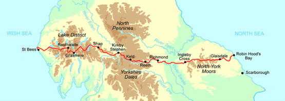
Today I left the Lake District with mixed feelings. My guidebook said that it wouldn't let me go without a struggle, and it was certainly one hell of a tussle. Whilst I have loved walking in the crags, knotts, pikes and fells, I am also looking forward to some level, less punishing walks. By the way, there are no Patterdale Terriers in Patterdale. I popped into the village shop to get some chocolate to go in my handy bag, as it is a pain to take the rucksack off every time. Glad I did, I needed all the energy I could muster.
This morning's walk started with the ascent to Boredale Hause and up to Angle Tarn. That was gruelling straight after breakfast. I really struggled to get going today, but was fine once the path became less rocky and really began to enjoy myself once out on the open fells again. So much so that I decided that a mere 12 miles planned with just the one pike (Kidsty, 784m) was just not challenging enough and went off my planned route to bag Rest Dodd (696m) and The Knott (739m) as well. This didn't add a lot of extra mileage, just more height and eventual leg ache. Although it did 'confuse' the GPS which was telling me I was going in the wrong direction (which of course I was, but only according to the route I had loaded in).
I had left Patterdale in good weather, expecting light rain as per the local weather forecast. Fair enough, me thinks, I knew the sunshine couldn't last. It started drizzling then got heavier. I stopped to don full waterproofs before bagging my extra Pikes. I had also planned a detour to High Raise (802m) until I saw the weather coming in. The rain probably was 'light' in Lake District terms, where it's an average of 130 inches of rain fall each year in Borrowdale; but it sure felt like it was nissing down to me. Visibility got poorer as the rain got heavier and the mist came down. Having already 'confused' the GPS, I missed my turn off for Kidsty Pike as I descended the Knott and carried on the old Roman road of High Street, heading back south for a while instead of east. The bonus of the GPS is that I soon realised I was wrong and was able to correct the error quickly. Not so for a couple who I saw going up as I came down and who I later found out were C2C'ers. They are probably still up there. As I turned on to the path up Kidsty Pike, I saw a man and his mum coming down to join the same path. He was wearing jeans, trainers, a fleece and a polythene poncho like you get at Alton Towers. She at least had boots on and a green cycling cape. You have to wonder, I was really worried about them. They had no map or compass, only a guide book and no idea where they were going. It was their chums who were going along High Street in the wrong direction. I showed them the path and walked in front of them so they could follow my red rucksack cover as by this time the visibility was down to about 30 feet. I was cold and very wet, but I had an energy boost as I scoffed half the bag of chocolate mini eggs bought earlier. Suffice to say there was no view from the top of Kidsty Pike.
Fortunately, the rain let up and the mists cleared for the rather gnarly descent to Haweswater Reservoir. There is a flooded village under there, which you can see at times of very low water, so not likely today then. I had a couple of comedy falls slipping on rocks on the way down, so my bruise collection is growing nicely. I found a spot out of the punishing winds and finally got to my coffee and lunch. Couldn't sit still too long though - need to keep moving to stay warm and avoid the midges. Dropping down to the water, the path then undulates (a lot) for 4 miles above the shore line of Haweswater and under the crags of Bampton Common. By the time I got to Burnbanks at the end of the reservoir, I was so glad that I only had another mile or so to head up into Bampton, rather then another 4 to get to Shap, where all of the other C2C'ers I have been walking with so far went.
As I headed to Bampton, it was obvious that the only pub in the village, despite still having a sign that said 'Always Open' was closed. I arrived at my B&B (The Village Post Office & Shop run by the amazing Janet and John) at 6.15pm, cold, wet and tired. Janet offered to phone ahead to Bampton Grange and book a table for me at the pub there, but said that I would need to head over there straight away - no time to shower and change. I couldn't face another walk, even if it was just for 10 mins, and I was too wet to be comfortable. I still had supplies in my case and said I was just going to have a bath and stay in. Janet offered to make me a sandwich, but because I felt that was imposing, I asked if she perhaps could let me have a bread roll? Meanwhile, John showed me to my lovely room - with a fantastic bathroom, and took my request for brekkie in the morning (I fancied sausages). 20 mins later Janet came back with a plate of cheese and tomato sandwiches, a salad with dressing, a packet of crisps, a bowl of strawberries and blueberries and a yogurt. I couldn't thank her enough and she refused to take any payment for such a lovely supper. Such kindness and hospitality I certainly won't forget.
One hot bath, a chat with Pete on Skype and a catch up of last night's Apprentice on iPlayer and I'm ready for a lovely deep sleep. I am amazed at today's stats as the paths really were hilly. A note on the stop times, as they may seem high: It's not just me sitting in the sun (!) for several hours instead of walking. The GPS takes account of all times when you are not moving along the grid references. So every time you pause to read the map, look at the scenery, re-tie boots, adjust kit, faff, wee wee etc. is all counted as stopped time. So there you go (or stop as the case may be). Today's tunes pop-pickers were ELO "Wild West Hero," Eurythmics "Here comes the rain again", Crowded House "Four Seasons in One Day" and of course Haircut 100 "Love Plus One" (as in Where do we go from here, is it down to the Lake I Fear?).
Odometer
14.8 miles
Cumulative Miles
66.2
Total Ascent
1045 metres
Total Descent
1057 metres
Moving Time
5h 54m
Stopped Time
3h 58m
Moving Average
2.5 mph


